Rivers of Costa Rica
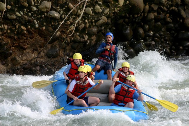
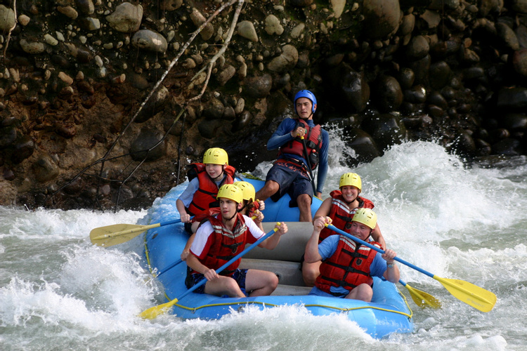
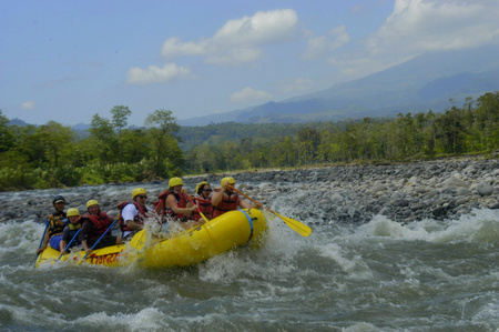
During the course of a single year many zones in Costa Rica receive between 150-200 inches of rain which keeps everything lush and green but also swells many river valleys as the water rushes throughout the country out to sea. With so much water Costa Rica has opted to use some rivers for hydro-electric projects which provides 80% of the Costa Ricas energy needs. In addition to a renewable energy source there are dozens of a river activities in Costa Rica ranging from action packed rafting adventures to slow paced wildlife observation floats.
The best places to visit in Rivers of Costa Rica
Sarapiqui River
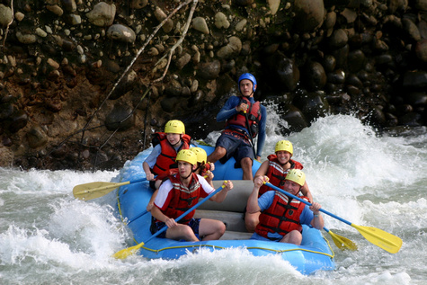
Originating from clear mountain streams, the Sarapiqui River runs from the Central Mountain Range just north of San Jose to the San Marcos River which runs along the shared border between Costa Rica and Nicaragua. The river is considered a national monument because of the vital service it provided in transporting arms, goods and soldiers in the 1856 war against the filibusters.
Penas Blancas River
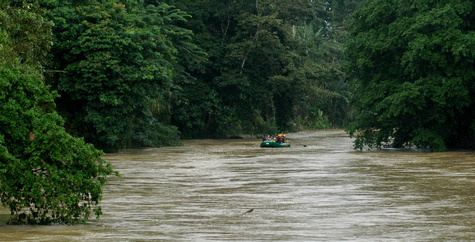
Known as the "white water gem of Costa Rica's Atlantic slope", the Penas Blancas River runs right through the Tilaran Mountain Range in north central Costa Rica. It then converges with the San Carlos River east of the Arenal Volcano.
Pacuare River
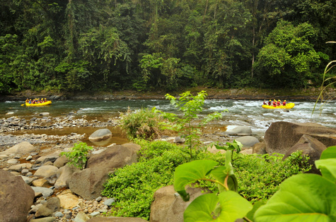
The Pacuare River, whose headwaters begin on the Atlantic slope in the Talamanca mountain range, runs about 68 miles (108 km) until reaching the Caribbean Sea on Costa Rica's central coast. This is the quintessential tropical river, with stunning scenery and abounding wildlife.
Savegre River
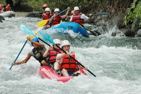
Beginning in the rainforest clad Talamanca Mountain Range between Cerro de los Muertos and Chirripo, the Savegre River flows south until reaching an estuary in the Manuel Antonio National Park, on the central Pacific coast of Costa Rica.
Tarcoles River
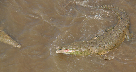
The Tárcoles River winds through Costa Rica's Central Pacific region before emptying into the Pacific Ocean. Its watershed provides a crucial habitat for a number of species (the most notable of which is the American crocodile), and although the river is somewhat polluted, it is significant for the country's residents, as nearly 60% of Costa Rica's total population lives along its basins.
Corobici River
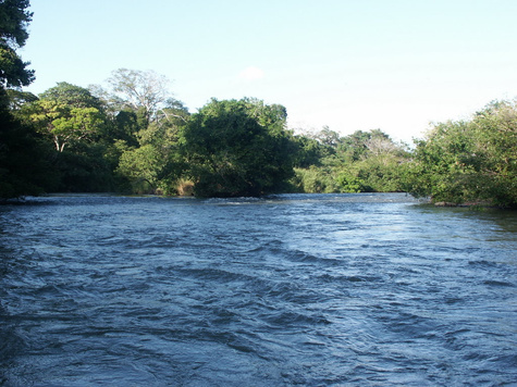
Originating in the Guanacaste mountain range in northwestern Costa Rica, the Corcobici River journeys south until reaching the estuary at the north end of the Gulf of Nicoya.
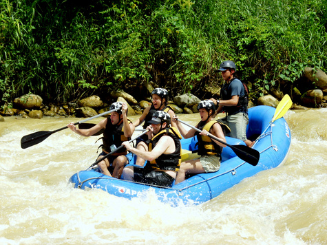
Naranjo River
Located just west of Rio Savegre, the Naranjo River's white water covers about 50 miles (80 km) of stunning terrain.
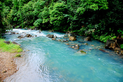
Rio Celeste
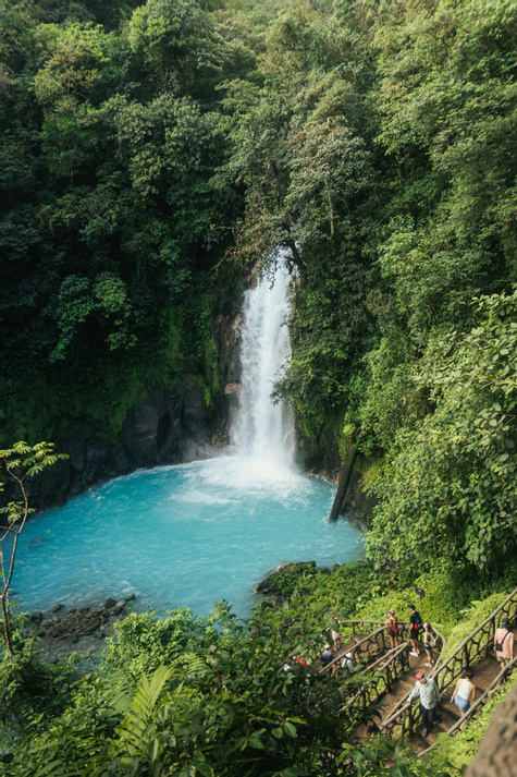
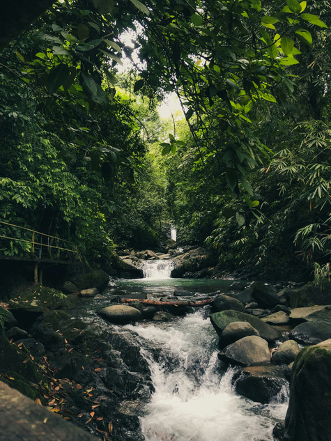
The Río Celeste winds through the verdant rainforest of Tenorio Volcano National Park. You can opt to see this bright blue river on a moderately challenging 4.5-mile (7.5 km) hike. It's also possible to take a 1-mile (1.5 km) hike that goes directly to the Río Celeste Waterfall from the entrance of the park.
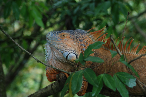
Rio Frio
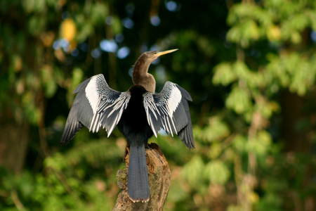
Stretching across northwestern Costa Rica and into Nicaragua is the calm Río Frío. The most visited portion of the river is certainly the section that goes through the Cano Negro Wildlife Refuge, a great destination for river safaris and wildlife viewing.
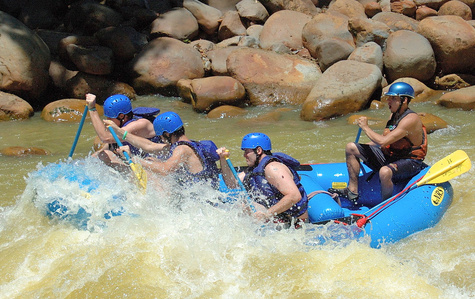
Toro River
Collecting its headwaters from the Poas Volcano, the Toro River heads straight for Costa Rica's northern border before turning east and reaching the Caribbean Sea's northeastern coast. The river runs through densely forested canyons, making for a truly spectacular setting.
Rivers of Costa Rica itineraries from local insiders
Explore hand-picked Rivers of Costa Rica itineraries designed by local insiders who know every hidden corner. Each trip is completely flexible, customized to your pace, travel style, and budget.
Pura Vida Adventure Together
We both love nature and hiking so Costa Rica is ideal for both of those. We went during what’s considered the rainy season so you need to be aware of that going in. It rained at some point almost every day we were there but we still had a very enjoyable time. We visited La Fortuna and Manuel Antonio. We enjoyed La Fortuna more. La Fortuna was more jungle whereas Manuel Antonio was more coastal and felt more touristy.
Costa Rica
Adventure Through Costa Rica's Wild Heart
Costa Rica was just magnificent. The people, food, jungles, beaches were all fantastic. Can’t wait until my next trip back.
Costa Rica
Big Multi Family Group Adventure
Embark on a vibrant Costa Rican adventure that juxtaposes bustling urban energy with lush, untouched rainforests, delivering a dynamic escape from everyday routine. From San José’s lively streets you’ll head to Monteverde’s cloud‑forest canopy for sky tram rides and hikes, then dive into Rio Celeste’s turquoise waters and trek El Silencio’s volcanic paths. Friendly locals and knowledgeable guides will immerse you in coffee farms, rainforest sounds, and volcanic vistas, leaving you with lasting memories of Costa Rica’s spirited hospitality and natural wonder.
Costa Rica
Matt and Fran’s Costa Rica holiday
Costa Rica has a diverse landscape and every area is unique and different. We easily rented a 4 wheel drive vehicle and drove from the Caribbean to the Pacific!
Costa Rica
Family Time in Costa Rica
Michelle and her family embarked on a multi‑generational adventure in Costa Rica, where mist‑cloaked cloud forests meet surf‑kissed Pacific beaches, offering a vibrant contrast of cool heights and warm tides. Your journey weaves through Monteverde’s canopy zip lines and canyoning thrills, the turquoise Tenorio River’s Class III/IV rapids, and La Leona waterfall’s lush river tubing. Guided by local experts and supported by a comfortable van, your family will soak up Pura Vida hospitality, returning home with shared stories of soaring forests and surf‑side sunsets.
Costa Rica
Family Adventure Through Costa Rica
Rachel and her family of four spent a week moving across Costa Rica, from Arenal to the Pacific coast, with every transfer and tour arranged door to door. In Arenal they rode the Sky Adventures aerial tram and ziplines, took on the Balsa River's Class II–III rapids, and walked the EcoGarden trails to find sloths in their actual habitat, not a roadside stop, then the falls at La Fortuna. On the coast at Manuel Antonio they hiked the national park with a local guide, snorkeled the reef, and chased the Mulguri waterfall. As Rachel said, these weren't tours with twenty other tourists trailing the buses. They were the real thing, reachable only through local connections, with the family's days handled start to finish.
Costa Rica
Dream Honeymoon Adventure in Costa Rica
Embark on a honeymoon that swaps city bustle for Costa Rica’s emerald rainforests and sun‑kissed beaches, where romance meets adventure in every sunrise. From Monteverde’s misty cloud forest trails to Arenal’s volcanic hot springs, then Playa Conchal’s Pacific surf and Damas Island’s mangrove kayak tours, you’ll hike, soak, and sail. Friendly local guides and vibrant community flavors will weave unforgettable memories, leaving you with a deeper connection to nature, Costa Rican warmth, and each other.
Costa Rica
Costa Rica Off Season Adventure
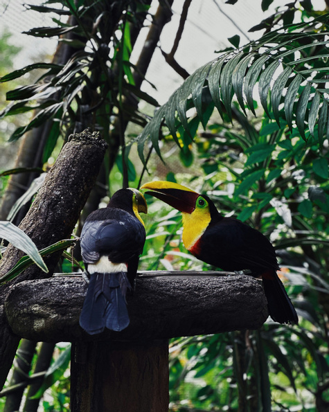
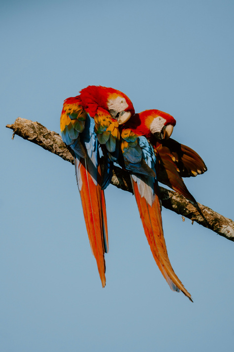
We found Costa Rica to be really beautiful. I loved the flowering plants everywhere, but the wildlife is the main reason we went. We didn't see monkeys in every tree or even toucans up close, but we did see them from a distance. We also saw lots of colorful birds in the National Forests that we have never seen before.
Costa Rica
Adventure Across Costa Rica's Wild Coast
The excursions and scenery are incredible.
Costa Rica
Costa Rica Family Adventure Quest
Embark on a vibrant Costa Rican family adventure that weaves together rainforest mist, volcanic fire, and Pacific surf, offering a dynamic contrast of nature’s extremes. Your journey moves from the sun‑kissed beaches of Manuel Antonio to Monteverde’s misty hanging bridges, then into Arenal’s volcano and waterfalls, ending with surf lessons in Tamarindo. Friendly local guides and coffee‑farm hosts will share traditions, flavors, and stories, leaving your family with lasting memories of Costa Rica’s warm hospitality and adventurous spirit.
Costa Rica
Tropical Adventure with Friends
Costa Rica is a beautiful place - the biodiversity in terms of animals and plant life is spectacular. The beaches, the natural landscapes - all of it is stunning. The people are kind and welcoming, truly living the Pura Vida lifestyle.
Costa Rica
Epic Mother‑Daughter Costa Rica Adventure
The flora and fauna are second to none. We saw and did so many incredible things The people are truly welcoming,, considerate and kind. The love for their country and their pleasure an pride in showing it to visitors shines through. The ease and safety of travelling around as s single mum with 2 daughters aged 12 and 15 without having to compromise on any experiences was s standout feature for me. Just a note: food and supermarkets are expensive - think US levels!
Costa Rica
Deep Journey into the Heart of Costa Rica
From misty cloud forests to sun‑kissed Pacific beaches, this Costa Rican adventure weaves together vibrant wildlife, volcanic landscapes, and endless ocean horizons. You’ll trek Monteverde’s canopy bridges, soak in Arenal’s hot springs, kayak mangroves at Drake Bay, and snorkel coral reefs off Manuel Antonio. Friendly local guides and community hosts will share traditions, cuisine, and conservation stories, leaving you with unforgettable memories of Costa Rica’s pura vida spirit.
Costa Rica
More Rivers of Costa Rica
There's always more to discover in Costa Rica. From off-the-beaten-path gems to well-loved classics, these rivers of costa rica are worth adding to your itinerary.
Reventazon River
Running alongside the Pacuare River to the west, the Revantazón River makes a run through the Atlantic slope of Costa Rica before reaching the Caribbean coast. The river is set in a tropical paradise, with dense primary tropical forests, sugar cane fields and lowland forests lining its edge.
Destination
Tempisque River
Originating in the foothills of the Orosi Volcano in northwest Costa Rica, the Tempisque River flows southeast until reaching the estuary on the northern end of the Nicoya Gulf. The river, stretching 86 miles (138 km), is considered to be the most important river in the Guanacaste region.
Destination
Insider-led Costa Rica Design & Concierge
Your insider team designs the trip around what you care about, then supports you in-country with private logistics, vetted partners, and concierge help when plans change.