


Tempisque River
Originating in the foothills of the Orosi Volcano in northwest Costa Rica, the Tempisque River flows southeast until reaching the estuary on the northern end of the Nicoya Gulf. The river, stretching 86 miles (138 km), is considered to be the most important river in the Guanacaste region.

More about Tempisque River
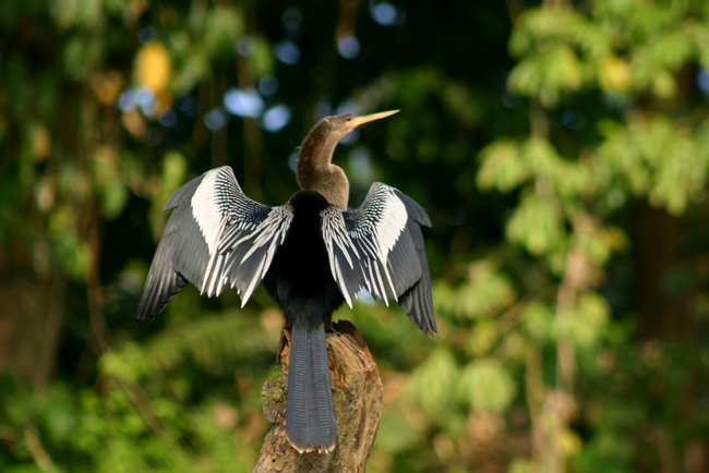
The Tempisque River's dry tropical forest is an important habitat for several different species of monkeys, crocodiles, iguanas, and migratory and aquatic birds such as the roseate spoonbill, white ibis, greets egret, little blue heron, tricoled heron, and bare throated tiger heron. The variety of birds in this region is the most extensive in the entire country.
The southern leg of the river passes through the Palo Verde National Park, a legitimate bird watching paradise, encompassing mangroves, swamp and both fresh water and salt water lagoons. It is a calm, relaxing float through one of Costa Rica’s prized national parks, an unforgettable experience.

Insider-led Costa Rica Design & Concierge
Your insider team designs the trip around what you care about, then supports you in-country with private logistics, vetted partners, and concierge help when plans change.
Get StartedPrivate drivers; English-speaking available.
Avoid the crowds in private day tours.
Better stays, better pacing, better reservations.
Insider-only experiences and exclusive local partners.
24/7 in-country support by phone, text, and WhatsApp.
Insider-led Costa Rica Design & Concierge
Your insider team designs the trip around what you care about, then supports you in-country with private logistics, vetted partners, and concierge help when plans change.

Real Voices, Real Benefits
We believe travel is more than ticking destinations off a list – it's about discovering new places deeply, feeling connected wherever you go, and knowing you have a trusted team of local experts behind you every step of the way.