


Santiaguito Volcano
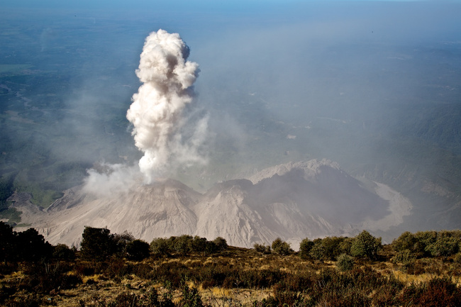
The 8,200-foot (2,500-m) Santiaguito Volcano is set within Guatemala’s Western Highlands near the town of Quetzaltenango. The volcano is active and belches smoke on a regular basis.

More about Santiaguito Volcano
The Santiaguito Volcano was created in the wake of the Santa María Volcano’s 1902 eruption. This eruption destroyed Santa María’s former summit and left some 5,000 people dead. It was one the largest eruptions of the 20th century.
Since then, new lava domes have grown inside the trench left by this eruption. Santiaguito is the youngest of these domes, having been created around 1922. The massive Santiaguito dome-complex has been growing ever since and is accompanied by continuous explosions, most of them minor. It belches smoke and ash on a regular basis, but sometimes emits lava and pyroclastic flows.
Most travelers are content to see Santiaguito from a distance. Hikes up the neighboring Santa María Volcano offer awesome views of the smoking Santiaguito, as does a half-day hike to a mirador overlooking the volcano.
More adventurous travelers may, however, be interested in the real deal—a hike up Santiaguito itself. Although less common, this is in fact a viable option. Some guiding companies will get you within a quarter mile of the crater. From this distance, you’ll understand the raw power of this incredible volcano.
Moments to look forward to
We Dreamt. Then We Went.
When we told our family and friend that we were going to Guatemala, their first impression was your kidding. The country is not safe. Let me say we had a fantastic time from beginning to end of our trip. Guatemala has a lot to present and the country has a lot of history and the people are wonderful. I would come back again. In general I would say we had no issues with the Itinerary and the drivers of Anywhere were very professional and most of all kept us safe where ever we went. The hotels that we stayed were very nice and in safe location.

Insider-led Guatemala Design & Concierge
Your insider team designs the trip around what you care about, then supports you in-country with private logistics, vetted partners, and concierge help when plans change.
Get StartedPrivate drivers; English-speaking available.
Avoid the crowds in private day tours.
Better stays, better pacing, better reservations.
Insider-only experiences and exclusive local partners.
24/7 in-country support by phone, text, and WhatsApp.
Insider-led Guatemala Design & Concierge
Your insider team designs the trip around what you care about, then supports you in-country with private logistics, vetted partners, and concierge help when plans change.

Real Voices, Real Benefits
We believe travel is more than ticking destinations off a list – it's about discovering new places deeply, feeling connected wherever you go, and knowing you have a trusted team of local experts behind you every step of the way.